Scientific profile
Associate Professor of the department of Highways, Geodesy and Land management,
Candidate of Technical Sciences (Ph. D.)
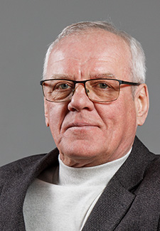
Volodymyr
FENENKO
Contacts and CV
Research
Current research
I take part in the implementation of scientific research work on the topic "Resource-saving methods of designing structures on soil bases and automated geographic information systems of real estate cadastral register" №0121U100385 (2021, 2022).
More
Past research
I have been participated in the implementation of research work on the topic "Improvement of Design Methods in Construction and Land Management" (№0116U000780) during 2016-2020.
More
Publications
1. Yurii Litvinov, Yevhen Terekhov and Volodymyr Fenenko. Improvement of open field development technology as a factor in the formation of quality and market value of reclaimed land. Ukrainian School of Mining Engineering Web of Conferences 123, (2019). – P. 1-13. [Електронний ресурс] – Режим доступу: https://www.e3s-conferences.org/articles/e3sconf/pdf/2019/49/e3sconf_usme2019_01045.pdf
2. Фененко В.И. Экономическое и организационное обеспечение воспроизводства земельных ресурсов при эксплуатации марганцевых месторождений, 2005. –. https://scholar.google.com.ua/citations?view_op=view_citation&hl=uk&user=yHic4PIAAAAJ&authuser=2&citation_for_view=yHic4PIAAAAJ:u-x6o8ySG0sC
3. Фененко В.І. Методика прогнозування втрат земельних ресурсів при відкритій розробці марганцевих родовищ / В.І. Фененко // Екологія і природокористування: Зб. наук. праць Інституту проблем природокористування та екології НАН України. – 2004. – Вип.7. – С. 111-116. [Електронний ресурс] – Режим доступу: https://scholar.google.com.ua/citations?view_op=view_citation&hl=uk&user=yHic4PIAAAAJ&authuser=2&citation_for_view=yHic4PIAAAAJ:u5HHmVD_uO8C
4. Технологія і економіка гірничого землекористування / В.І. Прокопенко, В.І. Фененко, О.О. Кириченко.–Дніпропетровськ: Наука і освіта, 2006.–270 с https://scholar.google.com.ua/citations?view_op=view_citation&hl=uk&user=yHic4PIAAAAJ&authuser=2&citation_for_view=yHic4PIAAAAJ:d1gkVwhDpl0C
Courses
1. Monitoring and land protection
The course "Monitoring and protection of lands" is a variable discipline from specialty 193 "Geodesy and land management". The subject of studying the discipline is knowledge and understanding of the general theoretical and methodological foundations of land monitoring.
The purpose of teaching the discipline is to learn and acquire the necessary theoretical knowledge and practical skills for the system of observations, their analysis and land protection.
2. Land management in the road sector
The course is aimed at students' formation of a system of theoretical knowledge and acquisition of practical skills in performing geodetic and land management works during the search, design, construction and operation of highways.
The discipline «Land management in the road sector» studies theoretical and practical techniques and methods of carrying out geodetic and land management works during the search, design and construction of highways, city streets and other transport linear and artificial structures.
3. Engineering geodesy
The subject of study of the academic discipline is the methods and means of geodetic measurements (angles, lengths of lines, elevations), the use of geodetic devices in solving engineering and geodetic problems in construction.
Students study in depth the methods of geodetic work used in the search, design, construction and operation of engineering buildings and structures.
During classroom lessons, students study geodetic tools, perform geodetic surveys, take out in nature on the terrain in accordance with the project characteristic points of buildings and structures and boundary marks.
Also, students prepare the necessary initial data for the design of field engineering and geodetic measurements. Techniques of basic geodetic work, geodetic surveying, field surveying are studied.
1930-2026
49005, Dnipro, Architect Oleh Petrov street, 24a.
+38 (056) 746-10-66
( 9:00 - 15:00 Mo - Fr )
postmaster@pdaba.edu.ua