Scientific profile
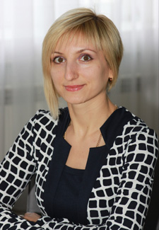
Associate Professor of the department of Highways, Geodesy and Land management,
Candidate of Technical Sciences (Ph. D.)., Associate Professor
Hanna
ISHUTINA
Contacts and CV
Research
Current research
I take part in the implementation of scientific research work on the topic "Resource-saving methods of designing structures on soil bases and automated geographic information systems of real estate cadastral register" №0121U100385 (2021, 2022).
More
Past research
During 2007-2010 I have been participated in the implementation of research work on the topic "Scientific fundamentals of resource conservation in the design of transport facilities and land management" (№0107U008795).
More
During 2011-2015 I have been participated in the implementation of research work on the topic "Resource-saving methods of designing in construction and land management" (№0111U006487).
More
I have been participated in the implementation of research work on the topic "Improvement of Design Methods in Construction and Land Management" (№0116U000780) during 2016-2020.
More
Publications
1. Антоненкова А.В. Створення геодинамічного полігону на території м. Дніпро на базі існуючих пунктів полігонометрії / А.В. Антоненкова, Г.С. Ішутіна, С.В. Бєгічев // Збірник матеріалів Х Міжнародної науково-технічної конференції студентів, аспірантів та молодих вчених «Молодь: наука та інновації». – Дніпро : НТУ «ДП», 2022 – С. 137-138. [Електронний ресурс]. – Режим доступу: https://rmv.nmu.org.ua/ua/arkhiv-zbirok-konferentsiy/molod-nauka-ta-innovatsii-2022/molod-2022.pdf
2. Антоненкова А.В. Визначення екологічно безпечних земельних ділянок шляхом застосування статистичних методів та ГІС-технологій при аналізі даних екомоніторингу / А.В. Антоненкова, Г.С. Ішутіна // Безпека життєдіяльності в XXІ столітті, 2021. – С. 28-30. [Електронний ресурс]. – Режим доступу: https://jm.snau.edu.ua/wp-content/uploads/2021/04/zbirnik-tez-dopov.-stud.konf.bzhd-2021-pdaba-1.pdf
3. Антоненкова А.В. Моделювання техногенного забруднення земель м. Дніпро / А.В. Антоненкова, Г.С. Ішутіна // Матеріали IX Всеукраїнської науково-технічної конференції студентів, аспірантів і молодих вчених «Молодь: наука та інновації». – Дніпро: НТУ «Дніпровська політехніка», 2021. – С. 147-148. [Електронний ресурс]. – Режим доступу: https://rmv.nmu.org.ua/ua/arkhiv-zbirok-konferentsiy/molod-nauka-ta-innovatsii-2021/molod-2021.pdf
4. Бєгічев С.В., Ішутіна Г.С. Обґрунтування супроводження містобудівельних проектів комплексом наукових досліджень екологічного стану земельних відводів під забудову / С.В. Бєгічев, Г.С. Ішутіна // Вісник ПДАБА. – №6 (271-272).–2020. –С. 46-57. [Електронний ресурс]. – Режим доступу: http://visnyk.pgasa.dp.ua/article/view/218912
5. Формування класифікації земельних ділянок та ринку нерухомості залежно від фактору техногенного забруднення території / С. В. Бєгічев, Г.С. Ішутіна, І.Г. Андреєва Збірник тез доповідей 24-ї Міжнародної конференціїGeoforum-2019 – Львів-Брюховичі-Яворів, 2019. – С. 36. [Електронний ресурс]. – Режим доступу: http://zgt.com.ua/wp-content/uploads/2019/04/%D0%A2%D0%95%D0%97%D0%98.pdf
Courses
1. Topography
Topography is the science of production measurements on the ground, determining the shape and size of the Earth and images of the earth's surface in the form of maps and plans.
The subject of study of the academic discipline is the methods of topographical and geodetic works. These methods are used when performing topographic surveys using modern technologies, for drawing up maps and plans that provide solutions to geodetic, land management and cadastral problems.
Knowledge of using geodetic tools, performing basic geodetic works, geodetic surveys will be obtained.
2. Geodesy
Geodesy is the science of accurately measuring and understanding three fundamental properties of the Earth: its geometric shape, its orientation in space, and its gravity field – as well as the changes of these properties with time. By using GPS, geodesists can monitor the movement of a site 24 hours a day, seven days a week. To measure points on the Earth’s surface, geodesists assign coordinates (similar to a unique address) to points all over the Earth. In the past, geodesists determined the coordinates of points by using Earth-based surveying tools to measure the distances between points. Today, geodesists use space-based tools like the Global Positioning System (GPS) to measure points on the Earth’s surface.
Geodesists must accurately define the coordinates of points on the surface of the Earth in a consistent manner. A set of accurately measured points is the basis for the National Spatial Reference System, which allows different kinds of maps to be consistent with one another.
3. Engineering geodesy
The subject of study of the academic discipline is the methods and means of geodetic measurements (angles, lengths of lines, elevations), the use of geodetic devices in solving engineering and geodetic problems in construction.
Students study in depth the methods of geodetic work used in the search, design, construction and operation of engineering buildings and structures.
During classroom lessons, students study geodetic tools, perform geodetic surveys, take out in nature on the terrain in accordance with the project characteristic points of buildings and structures and boundary marks.
Also, students prepare the necessary initial data for the design of field engineering and geodetic measurements. Techniques of basic geodetic work, geodetic surveying, field surveying are studied.
4. Photogrammetry and remote sensing
This discipline covers the issue of photogrammetric processing of both a single image and a stereo pair of images.
Photogrammetry is the science and technology of obtaining reliable information about physical objects and the environment through the process of recording, measuring and interpreting photographic images and patterns of electromagnetic radiant imagery and other phenomena.
Photographs have inherent distortions and displacements in them and the most common distortion in aerial photography is height distortion, followed by tilt displacement due to the aircraft’s movements. These distortions are easily removed through various photogrammetric processes. Other distortions such as image distortion are more difficult to correct. To understand the process of rectification one has to understand the inherent distortions and displacements in an aerial photograph.
Students learn to do removing geometric distortion from a raster or a vector object. Rectification is usually achieved by aligning raster features or vector coordinate positions with features on a base map or other coordinate reference framework.
Students transform images, study the occurrence of errors in photogrammetric imaging, the technology of terrestrial photogrammetric imaging, aerial photography, and space photography.
Also, during lectures, students learn methods of remote sensing, determining the shapes, sizes and locations of objects based on their images on photographic images, deciphering objects based on the spectral characteristics of a raster image.
5. Geodetic works in land management
The discipline covers the tasks of modern geodetic support of works in land management. Design objects and the stages of drafting land management projects, methods of determining the area of land plots are studied.
The technology of drawing up land use plans, principles of scale selection, correction of planning and cartographic materials, ways of transferring land management projects into nature, assessment of design accuracy and transfer of land plot boundaries into nature are considered.
Students master geodetic tools and methods of basic geodetic work and surveying. Students gain knowledge and acquire skills in using modern geodetic devices and geodetic surveying technologies, which are necessary for performing topographical and geodetic work in land management.
6. Engineering preparation of territories (fundamentals of geodesy)
The discipline covers the tasks of modern geodetic support during the construction and reconstruction of civil engineering objects. Planning and cartographic materials for conducting field and chamber search works with the aim of solving problems in the field of architecture and construction are considered.
Students master geodetic tools, gain knowledge about the basic methods of geodetic work and geodetic surveying.
Knowledge and skills in the use of modern geodetic devices and geodetic surveying technologies, which are necessary for performing topographical and geodetic works in the field of architecture and construction have been acquired.
1930-2026
49005, Dnipro, Architect Oleh Petrov street, 24a.
+38 (056) 746-10-66
( 9:00 - 15:00 Mo - Fr )
postmaster@pdaba.edu.ua